
Thank you for supporting this site ❤️
Make a donation
Make a donation
Gear up for your next adventure:
As an Amazon Associate, this site earns from qualifying purchases at no extra cost to you.
Cariatiz topographic map
Click on the map to display elevation.
Thank you for supporting this site ❤️
Make a donation
Make a donation
Gear up for your next adventure:
As an Amazon Associate, this site earns from qualifying purchases at no extra cost to you.
About this map
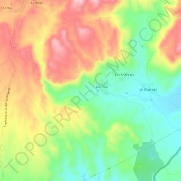
Name: Cariatiz topographic map, elevation, terrain.
Location: Cariatiz, Sorbas, Almería, Andalusië, Spanje (37.12481 -2.11191 37.16481 -2.07191)
Average elevation: 475 m
Minimum elevation: 372 m
Maximum elevation: 594 m
Thank you for supporting this site ❤️
Make a donation
Make a donation
Gear up for your next adventure:
As an Amazon Associate, this site earns from qualifying purchases at no extra cost to you.