
Monterey topographic map
Interactive map
Click on the map to display elevation.
About this map
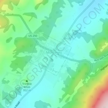
Name: Monterey topographic map, elevation, terrain.
Location: Monterey, Highland County, Virginia, United States (38.40608 -79.58749 38.41708 -79.57387)
Average elevation: 921 m
Minimum elevation: 835 m
Maximum elevation: 1,196 m
Other topographic maps
Click on a map to view its topography, its elevation and its terrain.
Bolar
United States > Virginia > Highland County
Bolar, Highland County, Virginia, United States
Average elevation: 798 m
McDowell
United States > Virginia > Highland County
McDowell, Highland County, Virginia, 24458, United States
Average elevation: 716 m
Trimble
United States > Virginia > Highland County > Trimble
Trimble, Highland County, Virginia, United States
Average elevation: 893 m