
Wynne topographic map
Interactive map
Click on the map to display elevation.
About this map
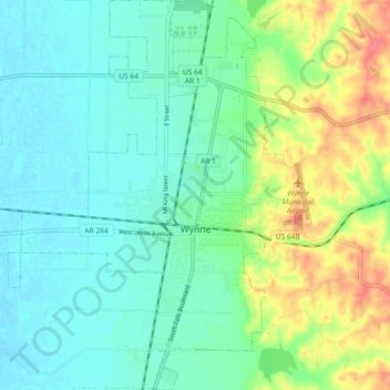
Name: Wynne topographic map, elevation, terrain.
Location: Wynne, Cross County, Arkansas, United States (35.19348 -90.83908 35.26860 -90.75935)
Average elevation: 87 m
Minimum elevation: 69 m
Maximum elevation: 127 m
Other topographic maps
Click on a map to view its topography, its elevation and its terrain.
Hickory Ridge
United States > Arkansas > Cross County
Hickory Ridge, Cross County, Arkansas, United States
Average elevation: 70 m