
Gunung Prau topographic map
Interactive map
Click on the map to display elevation.
About this map
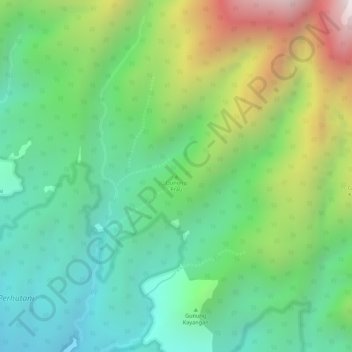
Name: Gunung Prau topographic map, elevation, terrain.
Location: Gunung Prau, Ponorogo, East Java, Java, Indonesia (-7.84435 111.72695 -7.84425 111.72705)
Average elevation: 1,464 m
Minimum elevation: 1,125 m
Maximum elevation: 2,069 m
Other topographic maps
Click on a map to view its topography, its elevation and its terrain.