Geolocate

Wolfeck topographic map

Click on the map to display elevation.

About this map

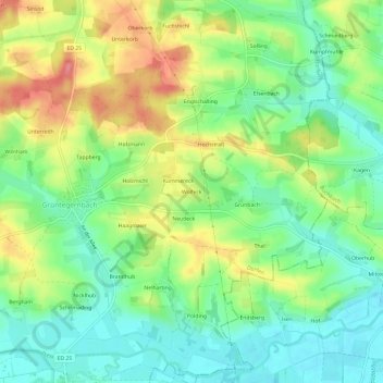
Name: Wolfeck topographic map, elevation, terrain.

Location: Wolfeck, Dorfen, Landkreis Erding, Bayern, 84419, Deutschland (48.27593 12.21358 48.31593 12.25358)

Average elevation: 457 m

Minimum elevation: 424 m

Maximum elevation: 507 m

Gear up for your next adventure:

🥾Mountaineering Boots - Supportive boots for climbing and high-altitude hiking
🛌Insulated Sleeping Pad - Critical thermal barrier between you and the cold ground
🗺️Topographic Maps - Detailed maps to explore trails, mountains, and wilderness areas
🦌Outdoor Trail Camera - Monitor wildlife activity near your favorite spots
🦶Anti-Blister Balm - Prevents friction and hotspots during long ascents

As an Amazon Associate, this site earns from qualifying purchases at no extra cost to you.