
Thank you for supporting this site ❤️
Make a donation
Make a donation
Gear up for your next adventure:
As an Amazon Associate, this site earns from qualifying purchases at no extra cost to you.
Cochapamba topographic map
Click on the map to display elevation.
Thank you for supporting this site ❤️
Make a donation
Make a donation
Gear up for your next adventure:
As an Amazon Associate, this site earns from qualifying purchases at no extra cost to you.
About this map
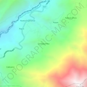
Name: Cochapamba topographic map, elevation, terrain.
Location: Cochapamba, Huigra, Alausí, Chimborazo, Ecuador (-2.33244 -79.00760 -2.29244 -78.96760)
Average elevation: 1,808 m
Minimum elevation: 1,082 m
Maximum elevation: 3,240 m
Thank you for supporting this site ❤️
Make a donation
Make a donation
Gear up for your next adventure:
As an Amazon Associate, this site earns from qualifying purchases at no extra cost to you.