Geolocate

Magapi topographic map

Click on the map to display elevation.

About this map

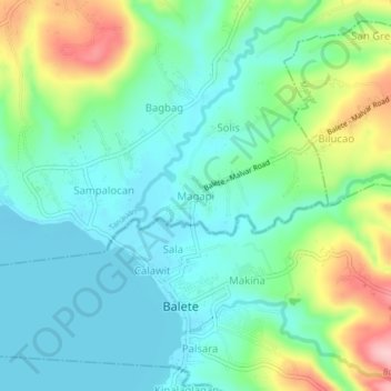
Name: Magapi topographic map, elevation, terrain.

Location: Magapi, Balete, Batangas, Calabarzon, 4219, Philippines (14.00870 121.07695 14.04870 121.11695)

Average elevation: 52 m

Minimum elevation: 1 m

Maximum elevation: 184 m

Gear up for your next adventure:

🗺️Topographic Maps - Detailed maps to explore trails, mountains, and wilderness areas
🔥Emergency Fire Starter - Reliable ignition source for all weather conditions
🎒Fully Waterproof Backpack - Total protection for photography gear and electronics
🧼Biodegradable Camp Soap - Environmentally friendly cleaning for gear and body
🪑Insulated Seat Pad - Protect your seat from cold rocks and wet logs

As an Amazon Associate, this site earns from qualifying purchases at no extra cost to you.