Geolocate

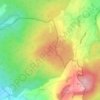
Maar topographic map

Click on the map to display elevation.

About this map

Name: Maar topographic map, elevation, terrain.

Location: Maar, Lauterbach (Hessen), Vogelsbergkreis, Hessen, Duitsland (50.64737 9.35088 50.70406 9.42864)

Average elevation: 373 m

Minimum elevation: 294 m

Maximum elevation: 474 m

Other topographic maps

Click on a map to view its topography, its elevation and its terrain.
Dick

Duitsland > Hessen > Vogelsbergkreis > Alsfeld

Average elevation: 378 m

Gear up for your next adventure:

❄️Traction Ice Cleats - Slip-on spikes for icy trails and winter hiking
🧼Travel Hand Sanitizer - Keep hands clean when water is scarce
💧Hydration Bladder - Hands-free hydration solution for long treks
🧣Merino Neck Gaiter - Protects against wind, sun, and cold at high altitudes
🥾Hiking Shoes - Durable and comfortable shoes for trail hiking

As an Amazon Associate, this site earns from qualifying purchases at no extra cost to you.