Geolocate

Largo topographic map

Click on the map to display elevation.

About this map

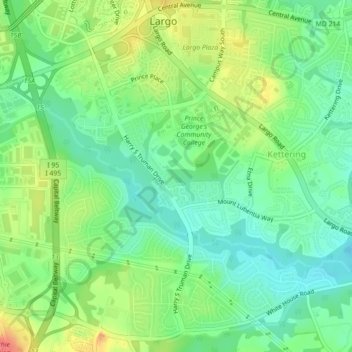
Name: Largo topographic map, elevation, terrain.

Location: Largo, Prince George's County, Maryland, United States (38.86637 -76.84716 38.89833 -76.80281)

Average elevation: 41 m

Minimum elevation: 18 m

Maximum elevation: 78 m

Gear up for your next adventure:

🛌Down Sleeping Bag - Superior warmth-to-weight ratio for cold nights
🌡️Emergency Mylar Blankets - Compact thermal protection for unexpected nights outdoors
🔦LED Headtorch - Bright and durable light for night activities
🥾Lightweight Hiking Boots - Boots for comfort and mobility on long hikes
🧢Beanie Hat - Keep your head warm in cold weather

As an Amazon Associate, this site earns from qualifying purchases at no extra cost to you.