Geolocate

Fraser topographic map

Click on the map to display elevation.

About this map

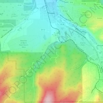
Name: Fraser topographic map, elevation, terrain.

Location: Fraser, Grand County, Colorado, United States (39.90779 -105.82230 39.95298 -105.77621)

Average elevation: 2,696 m

Minimum elevation: 2,599 m

Maximum elevation: 2,888 m

Gear up for your next adventure:

👟Leg Gaiters - Keep debris, mud, and snow out of your boots
🥾Mountain Trail Shoes - High-traction shoes for mountain trails
🥾Approach Shoes - Shoes designed for climbing approaches and rugged trails
💡Compact LED Flashlight - Powerful and portable flashlight for outdoor use
🦟Insect Repellent - Keep mosquitoes and black flies away in wooded areas

As an Amazon Associate, this site earns from qualifying purchases at no extra cost to you.