Geolocate

Sinobong topographic map

Click on the map to display elevation.

About this map

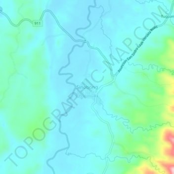
Name: Sinobong topographic map, elevation, terrain.

Location: Sinobong, Veruela, Agusan del Sur, Caraga, 8509, Philippines (7.94391 125.90159 7.98391 125.94159)

Average elevation: 74 m

Minimum elevation: 39 m

Maximum elevation: 260 m

Gear up for your next adventure:

🛌Insulated Sleeping Pad - Critical thermal barrier between you and the cold ground
🔥Emergency Fire Starter - Reliable ignition source for all weather conditions
🚲Bike Repair Kit - Essential tools for on-trail mechanical issues
🥾Trail Hiking Boots - Supportive boots for rough trails
🥾All-Terrain Hiking Boots - Versatile boots for varied hiking conditions

As an Amazon Associate, this site earns from qualifying purchases at no extra cost to you.