
Thank you for supporting this site ❤️
Make a donation
Make a donation
Gear up for your next adventure:
As an Amazon Associate, this site earns from qualifying purchases at no extra cost to you.
Teglia topographic map
Click on the map to display elevation.
Thank you for supporting this site ❤️
Make a donation
Make a donation
Gear up for your next adventure:
As an Amazon Associate, this site earns from qualifying purchases at no extra cost to you.
About this map
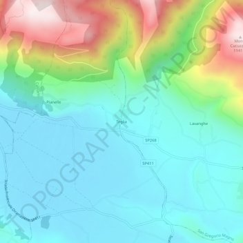
Name: Teglia topographic map, elevation, terrain.
Location: Teglia, San Gregorio Magno, Salerno, Campania, 84021, Italia (40.65260 15.32767 40.69260 15.36767)
Average elevation: 616 m
Minimum elevation: 430 m
Maximum elevation: 1,146 m
Thank you for supporting this site ❤️
Make a donation
Make a donation
Gear up for your next adventure:
As an Amazon Associate, this site earns from qualifying purchases at no extra cost to you.