Geolocate

Bad Emstal topographic map

Click on the map to display elevation.

About this map
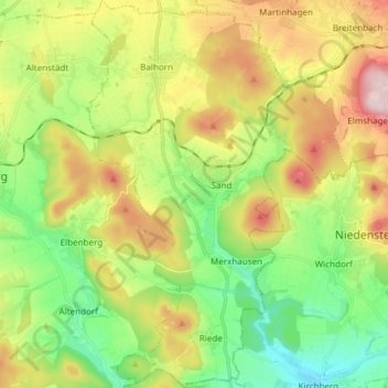
Name: Bad Emstal topographic map, elevation, terrain.

Location: Bad Emstal, Landkreis Kassel, Hessen, 34308, Duitsland (51.19589 9.20728 51.29023 9.30914)

Average elevation: 319 m

Minimum elevation: 189 m

Maximum elevation: 519 m

Gear up for your next adventure:

🕶️Polarized Sunglasses - Reduces glare from snow and water at high elevations
🧤Thermal Hiking Gloves - Grip-enhanced gloves for cold-weather altitude trekking
🧥Thermal Layer - Insulating layer for cold outdoor conditions
🥾Waterproof Hiking Boots - Essential footwear for rugged terrain and wet Canadian trails
🥾Mountaineering Boots - Supportive boots for climbing and high-altitude hiking

As an Amazon Associate, this site earns from qualifying purchases at no extra cost to you.