Geolocate

Kirkham topographic map

Click on the map to display elevation.

About this map

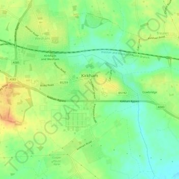
Name: Kirkham topographic map, elevation, terrain.

Location: Kirkham, Borough of Fylde, Lancashire, England, United Kingdom (53.76979 -2.91078 53.79063 -2.85681)

Average elevation: 22 m

Minimum elevation: 3 m

Maximum elevation: 42 m

Other topographic maps

Click on a map to view its topography, its elevation and its terrain.

Gear up for your next adventure:

🔋Solar Power Bank - Keep your GPS and devices charged during long outdoor trips
🧶550 Survival Paracord - Versatile utility cord for emergency repairs and rigging
🧼Travel Hand Sanitizer - Keep hands clean when water is scarce
🥾Mountain Hiking Shoes - Shoes with superior grip for mountainous terrain
🛶Kayak Accessories - Essential gear for safe and fun kayaking adventures

As an Amazon Associate, this site earns from qualifying purchases at no extra cost to you.