
Thank you for supporting this site ❤️
Make a donation
Make a donation
Gear up for your next adventure:
As an Amazon Associate, this site earns from qualifying purchases at no extra cost to you.
Danar topographic map
Click on the map to display elevation.
Thank you for supporting this site ❤️
Make a donation
Make a donation
Gear up for your next adventure:
As an Amazon Associate, this site earns from qualifying purchases at no extra cost to you.
About this map
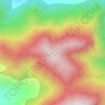
Name: Danar topographic map, elevation, terrain.
Location: Danar, Bandipora, Bandipore, Jammu und Kaschmir, Indien (34.38917 74.73838 34.38927 74.73848)
Average elevation: 2,445 m
Minimum elevation: 1,908 m
Maximum elevation: 2,895 m
Thank you for supporting this site ❤️
Make a donation
Make a donation
Gear up for your next adventure:
As an Amazon Associate, this site earns from qualifying purchases at no extra cost to you.