Geolocate

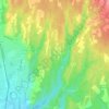
Arcisate topographic map

Click on the map to display elevation.

About this map

Name: Arcisate topographic map, elevation, terrain.

Location: Arcisate, Comunità Montana del Piambello, Varese, Lombardy, 21051, Italy (45.82654 8.83869 45.88401 8.89633)

Average elevation: 454 m

Minimum elevation: 312 m

Maximum elevation: 1,004 m

Other topographic maps

Click on a map to view its topography, its elevation and its terrain.

Due Cossani

Italy > Lombardy > Varese

Average elevation: 599 m

Santa Maria del monte

Italy > Lombardy > Varese > Varese

Average elevation: 689 m

Pianbosco

Italy > Lombardy > Varese > Venegono Inferiore

Average elevation: 368 m

Case Nuove

Italy > Lombardy > Varese > Somma Lombardo

Average elevation: 218 m

Vizzola Ticino

Italy > Lombardy > Varese > Vizzola Ticino

Average elevation: 197 m

Gear up for your next adventure:

🥾All-Terrain Hiking Boots - Versatile boots for varied hiking conditions
🧥Waterproof Hiking Jacket - Protect yourself from rain and wind while hiking
💡LED Camping Lantern - Illuminate your campsite with long-lasting lanterns
💧Reusable Water Bottle - Durable water bottles for hydration on trails
🧥Softshell Jacket - Windproof and breathable jacket for hiking

As an Amazon Associate, this site earns from qualifying purchases at no extra cost to you.