Geolocate

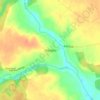
Horodnia topographic map

Click on the map to display elevation.

About this map

Name: Horodnia topographic map, elevation, terrain.

Location: Horodnia, Городнянська міська громада, Chernihiv Raion, Chernihiv Oblast, 15100, Ukraine (51.87075 31.55595 51.91072 31.62879)

Average elevation: 139 m

Minimum elevation: 121 m

Maximum elevation: 153 m

Other topographic maps

Click on a map to view its topography, its elevation and its terrain.

Varva

Ukraine > Chernihiv Oblast

Varva altitude - 153 meters (501.969 ft) above sea level.

Average elevation: 127 m
Orlivka

Ukraine > Chernihiv Oblast

Average elevation: 174 m

Syrai

Ukraine > Chernihiv Oblast

Average elevation: 115 m

Kudrivka

Ukraine > Chernihiv Oblast

Average elevation: 138 m

Dnipro

Ukraine > Chernihiv Oblast

The source of the Dnieper is the sedge bogs (Akseninsky Mokh) of the Valdai Hills in central Russia, at an elevation of 220 m (720 ft). For 115 km (71 mi) of its length, it serves as the border between Belarus and Ukraine. Its estuary, or liman, used to be defended by the strong fortress of Ochakiv.

Average elevation: 110 m
Novenke

Ukraine > Chernihiv Oblast

Average elevation: 183 m

Dmytrivka

Ukraine > Chernihiv Oblast

Average elevation: 147 m

Tynytsia

Ukraine > Chernihiv Oblast

Average elevation: 151 m

Tabaivka

Ukraine > Chernihiv Oblast

Average elevation: 141 m

Dnipro

Ukraine > Chernihiv Oblast

The source of the Dnieper is the sedge bogs (Akseninsky Mokh) of the Valdai Hills in central Russia, at an elevation of 220 m (720 ft). For 115 km (71 mi) of its length, it serves as the border between Belarus and Ukraine. Its estuary, or liman, used to be defended by the strong fortress of Ochakiv.

Average elevation: 108 m

Perevolochna

Ukraine > Chernihiv Oblast

Average elevation: 113 m

Dnipro

Ukraine > Chernihiv Oblast

The source of the Dnieper is the sedge bogs (Akseninsky Mokh) of the Valdai Hills in central Russia, at an elevation of 220 m (720 ft). For 115 km (71 mi) of its length, it serves as the border between Belarus and Ukraine. Its estuary, or liman, used to be defended by the strong fortress of Ochakiv.

Average elevation: 110 m

Karasynivka

Ukraine > Chernihiv Oblast

Average elevation: 114 m

Kozelets

Ukraine > Chernihiv Oblast

Average elevation: 113 m

Dnipro

Ukraine > Chernihiv Oblast

The source of the Dnieper is the sedge bogs (Akseninsky Mokh) of the Valdai Hills in central Russia, at an elevation of 220 m (720 ft). For 115 km (71 mi) of its length, it serves as the border between Belarus and Ukraine. Its estuary, or liman, used to be defended by the strong fortress of Ochakiv.

Average elevation: 110 m
Syrai

Ukraine > Chernihiv Oblast

Average elevation: 115 m

Hapishkivka

Ukraine > Chernihiv Oblast

Average elevation: 118 m

Yahidne

Ukraine > Chernihiv Oblast

Average elevation: 117 m

Хабинь

Ukraine > Chernihiv Oblast

Average elevation: 118 m

Chernatske

Ukraine > Chernihiv Oblast

Average elevation: 148 m

Morivsk

Ukraine > Chernihiv Oblast > Morivsk

Average elevation: 109 m

Gear up for your next adventure:

🔦UV Flashlight - Detect minerals or specific insects in the dark
🥽Outdoor Goggles - Protective eyewear for outdoor activities
👟Leg Gaiters - Keep debris, mud, and snow out of your boots
🧢Outdoor Visor - Breathable visor for sunny hikes
🧶550 Survival Paracord - Versatile utility cord for emergency repairs and rigging

As an Amazon Associate, this site earns from qualifying purchases at no extra cost to you.