Geolocate

Tancoco topographic map

Click on the map to display elevation.

👉 Easily get elevation data in JSON, GeoTIFF and KML formats using Elevation API
Thank you for supporting this site ❤️
Make a donation

About this map

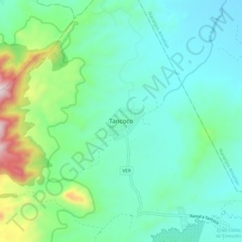
Name: Tancoco topographic map, elevation, terrain.

Location: Tancoco, Veracruz, Mexico (21.24643 -97.83160 21.32643 -97.75160)

Average elevation: 291 m

Minimum elevation: 98 m

Maximum elevation: 1,000 m

Gear up for your next adventure:

🔋Lithium AA Batteries - Long-lasting power that performs in extreme cold
🌡️Emergency Mylar Blankets - Compact thermal protection for unexpected nights outdoors
🧤Insulated Winter Gloves - Heavy-duty protection for sub-zero Canadian adventures
🥾Hiking Shoes - Durable and comfortable shoes for trail hiking
🚑Survival Whistle - Signal for help across long distances in mountains

As an Amazon Associate, this site earns from qualifying purchases at no extra cost to you.