Geolocate

Obong topographic map

Click on the map to display elevation.

About this map

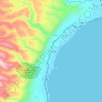
Name: Obong topographic map, elevation, terrain.

Location: Obong, Dalaguete, Cebu, Central Visayas, 6023, Philippines (9.72152 123.49087 9.76152 123.53087)

Average elevation: 118 m

Minimum elevation: 0 m

Maximum elevation: 420 m

Gear up for your next adventure:

🔦LED Flashlight - Powerful and long-lasting flashlight for camping and emergencies
🦶Hiking Shoe Insoles - Added support for high arches and long days on feet
🥾Trail Running Boots - Durable shoes designed for trail running
🥽Outdoor Goggles - Protective eyewear for outdoor activities
🥾Waterproof Hiking Boots - Boots keeping your feet dry in wet conditions

As an Amazon Associate, this site earns from qualifying purchases at no extra cost to you.