
Thank you for supporting this site ❤️
Make a donation
Make a donation
Gear up for your next adventure:
As an Amazon Associate, this site earns from qualifying purchases at no extra cost to you.
Bustelo topographic map
Click on the map to display elevation.
Thank you for supporting this site ❤️
Make a donation
Make a donation
Gear up for your next adventure:
As an Amazon Associate, this site earns from qualifying purchases at no extra cost to you.
About this map
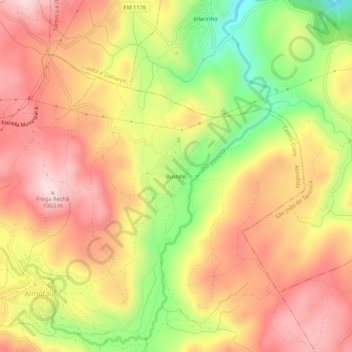
Name: Bustelo topographic map, elevation, terrain.
Location: Bustelo, Almofala, Castro Daire, Viseu, 3600-011, Portugal (40.94748 -7.79286 40.98748 -7.75286)
Average elevation: 860 m
Minimum elevation: 667 m
Maximum elevation: 998 m
Thank you for supporting this site ❤️
Make a donation
Make a donation
Gear up for your next adventure:
As an Amazon Associate, this site earns from qualifying purchases at no extra cost to you.