Geolocate

Shahpur topographic map

Click on the map to display elevation.

About this map

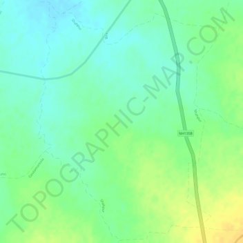
Name: Shahpur topographic map, elevation, terrain.

Location: Shahpur, Semaria Tahsil, Rewa District, Madhya Pradesh, India (24.69530 81.23014 24.72178 81.25245)

Average elevation: 286 m

Minimum elevation: 273 m

Maximum elevation: 302 m

Gear up for your next adventure:

🧢Outdoor Visor - Breathable visor for sunny hikes
🧭Orienteering Kit - Tools for map reading and navigation in the wild
🥾Waterproof Hiking Boots - Boots keeping your feet dry in wet conditions
💧Filtered Water Bottle - Safe drinking water on the go
🧢Beanie Hat - Keep your head warm in cold weather

As an Amazon Associate, this site earns from qualifying purchases at no extra cost to you.