Geolocate

Zuleta topographic map

Click on the map to display elevation.

About this map

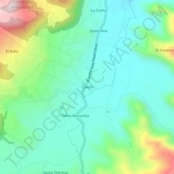
Name: Zuleta topographic map, elevation, terrain.

Location: Zuleta, Angochagua, Ibarra, Imbabura, 100114, Ecuador (0.18735 -78.11151 0.22735 -78.07151)

Average elevation: 2,977 m

Minimum elevation: 2,813 m

Maximum elevation: 3,416 m

Gear up for your next adventure:

🥾Lightweight Hiking Boots - Boots for comfort and mobility on long hikes
🚲Heavy Duty Bike Lock - Secure your bike at the trailhead or during stops
🧥Softshell Hiking Jacket - The perfect balance of wind protection and breathability
🏃Hydration Running Vest - Carry water and maps close to your body for speed
🔦UV Flashlight - Detect minerals or specific insects in the dark

As an Amazon Associate, this site earns from qualifying purchases at no extra cost to you.