Geolocate

Manley topographic map

Click on the map to display elevation.

About this map

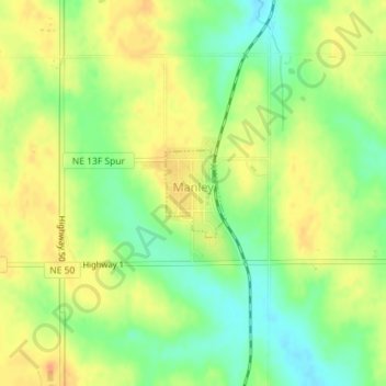
Name: Manley topographic map, elevation, terrain.

Location: Manley, Cass County, Nebraska, 68403, United States (40.91611 -96.16864 40.92221 -96.16303)

Average elevation: 387 m

Minimum elevation: 366 m

Maximum elevation: 405 m

Gear up for your next adventure:

🔭Outdoor Binoculars - Lightweight binoculars for birdwatching and hiking
🧥Insulated Jacket - Keep warm in cold outdoor conditions
Backpacking Tent - Lightweight tent for long-distance hiking trips
🥾Mountain Hiking Boots - High-traction boots for rocky terrain
🧥Fleece Jacket - Warm and lightweight jacket for layering

As an Amazon Associate, this site earns from qualifying purchases at no extra cost to you.