
Covesville topographic map
Click on the map to display elevation.
About this map
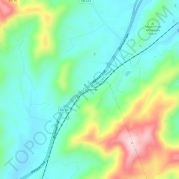
Name: Covesville topographic map, elevation, terrain.
Location: Covesville, Albemarle County, Virginia, 22931, United States (37.86980 -78.72426 37.90980 -78.68426)
Average elevation: 300 m
Minimum elevation: 194 m
Maximum elevation: 551 m
Other topographic maps
Click on a map to view its topography, its elevation and its terrain.
Darden Towe Park
United States > Virginia > Albemarle County > Charlottesville > Franklin
Average elevation: 129 m
Beaver Creek Park
United States > Virginia > Albemarle County > Charlottesville > Wickham Pond
Average elevation: 185 m