Geolocate

Coroneo topographic map

Click on the map to display elevation.

About this map

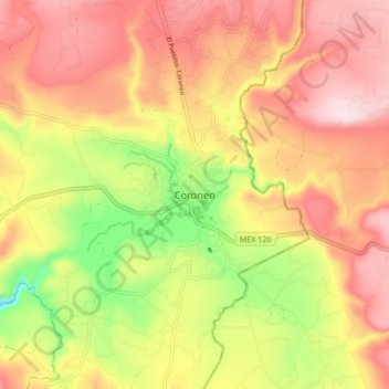
Name: Coroneo topographic map, elevation, terrain.

Location: Coroneo, Guanajuato, 38590, Mexico (20.15878 -100.40532 20.23878 -100.32532)

Average elevation: 2,354 m

Minimum elevation: 2,140 m

Maximum elevation: 2,513 m

Gear up for your next adventure:

🧴Sunscreen SPF - Broad-spectrum sunscreen for outdoor activities
🧢Outdoor Visor - Breathable visor for sunny hikes
Backpacking Tent - Lightweight tent for long-distance hiking trips
🔪Outdoor Multitool - Versatile tool for repairs and food prep in the wild
🥽Outdoor Goggles - Protective eyewear for outdoor activities

As an Amazon Associate, this site earns from qualifying purchases at no extra cost to you.