Geolocate

Godalming topographic map

Click on the map to display elevation.

About this map

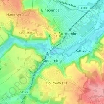
Name: Godalming topographic map, elevation, terrain.

Location: Godalming, Waverley, Surrey, England, United Kingdom (51.16986 -0.64093 51.20806 -0.58489)

Average elevation: 71 m

Minimum elevation: 31 m

Maximum elevation: 133 m

Gear up for your next adventure:

🌡️Emergency Mylar Blankets - Compact thermal protection for unexpected nights outdoors
Lightweight Backpacking Tent - Compact tent for efficient hiking trips
🗺️Topographic Maps - Detailed maps to explore trails, mountains, and wilderness areas
🧢Hiking Hat - Sun-protective and breathable hats for long treks
🧢Sun Protection Cap - Breathable cap to protect from sun exposure

As an Amazon Associate, this site earns from qualifying purchases at no extra cost to you.