
Make a donation
Gear up for your next adventure:
As an Amazon Associate, this site earns from qualifying purchases at no extra cost to you.
Hasel topographic map
Click on the map to display elevation.
Make a donation
Gear up for your next adventure:
As an Amazon Associate, this site earns from qualifying purchases at no extra cost to you.
Hasel
Nachfolgend findet sich eine im Uhrzeigersinn von Westen nach Osten geordnete Aufstellung, die auch Zuflüsse höherer Ordnung berücksichtigt. Für eine Ordnung in Fließrichtung der Hasel ist die Tabelle nach den Fließgewässerkennziffern (DGKZ) zu ordnen.
Make a donation
Gear up for your next adventure:
As an Amazon Associate, this site earns from qualifying purchases at no extra cost to you.
About this map
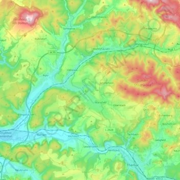
Name: Hasel topographic map, elevation, terrain.
Average elevation: 442 m
Minimum elevation: 295 m
Maximum elevation: 740 m
Make a donation
Gear up for your next adventure:
As an Amazon Associate, this site earns from qualifying purchases at no extra cost to you.