Geolocate

Lingen (Ems) topographic map

Click on the map to display elevation.

About this map

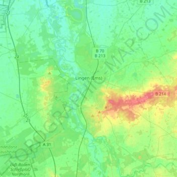
Name: Lingen (Ems) topographic map, elevation, terrain.

Location: Lingen (Ems), Landkreis Emsland, Lower Saxony, Germany (52.42012 7.19355 52.60221 7.45399)

Average elevation: 29 m

Minimum elevation: 14 m

Maximum elevation: 72 m

Gear up for your next adventure:

🧥Thermal Layer - Insulating layer for cold outdoor conditions
🧭Orienteering Kit - Tools for map reading and navigation in the wild
💧Reusable Water Bottle - Durable water bottles for hydration on trails
🥾Lightweight Hiking Boots - Boots for comfort and mobility on long hikes
Lightweight Camping Tent - Portable shelter optimized for Canadian backcountry camping

As an Amazon Associate, this site earns from qualifying purchases at no extra cost to you.