Geolocate

Oceanair topographic map

Click on the map to display elevation.

About this map

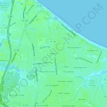
Name: Oceanair topographic map, elevation, terrain.

Location: Oceanair, Norfolk, Virginia, 23503, United States (36.91681 -76.26522 36.95681 -76.22522)

Average elevation: 4 m

Minimum elevation: -2 m

Maximum elevation: 9 m

Other topographic maps

Click on a map to view its topography, its elevation and its terrain.

Lake Taylor

United States > Virginia > Norfolk > Lake Terrace

Average elevation: 7 m

Broad Creek

United States > Virginia > Norfolk > River Oaks

Average elevation: 6 m

Gear up for your next adventure:

🌬️Windproof Camp Stove - Efficient cooking even on exposed mountain peaks
🥾Approach Shoes - Shoes designed for climbing approaches and rugged trails
🥾Hiking Boots - Sturdy boots providing ankle support and traction on rugged trails
🗺️Topographic Maps - Detailed maps to explore trails, mountains, and wilderness areas
🧥Packable Rain Jacket - Breathable waterproof layer for unpredictable weather

As an Amazon Associate, this site earns from qualifying purchases at no extra cost to you.