
Thank you for supporting this site ❤️
Make a donation
Make a donation
Gear up for your next adventure:
As an Amazon Associate, this site earns from qualifying purchases at no extra cost to you.
Urraca-Miguel topographic map
Click on the map to display elevation.
Thank you for supporting this site ❤️
Make a donation
Make a donation
Gear up for your next adventure:
As an Amazon Associate, this site earns from qualifying purchases at no extra cost to you.
About this map
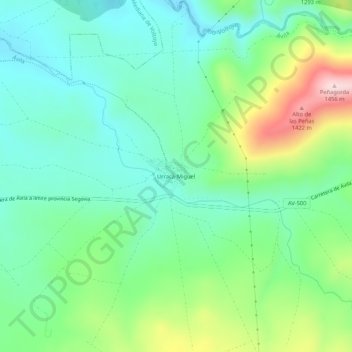
Name: Urraca-Miguel topographic map, elevation, terrain.
Location: Urraca-Miguel, Ávila, Castilië en León, Spanje (40.65232 -4.54221 40.69232 -4.50221)
Average elevation: 1,217 m
Minimum elevation: 1,119 m
Maximum elevation: 1,453 m
Thank you for supporting this site ❤️
Make a donation
Make a donation
Gear up for your next adventure:
As an Amazon Associate, this site earns from qualifying purchases at no extra cost to you.