Geolocate

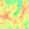
53970 topographic map

Click on the map to display elevation.

About this map

Name: 53970 topographic map, elevation, terrain.

Location: 53970, Nuillé-sur-Vicoin, Laval, Mayenne, Pays de la Loire, France métropolitaine, France (47.95229 -0.84726 48.04113 -0.72831)

Average elevation: 89 m

Minimum elevation: 0 m

Maximum elevation: 127 m

Other topographic maps

Click on a map to view its topography, its elevation and its terrain.

Gear up for your next adventure:

🧰Multitool Knife - Compact and versatile tool for outdoor use
🥾Waterproof Trail Shoes - Shoes designed to handle wet terrain
🛰️Satellite Messenger - Emergency communication for areas with no cell service
🎒Hiking Backpack - Lightweight and ergonomic backpacks for day hikes or multi-day treks
🌬️Windproof Camp Stove - Efficient cooking even on exposed mountain peaks

As an Amazon Associate, this site earns from qualifying purchases at no extra cost to you.