Geolocate

Marienborn topographic map

Click on the map to display elevation.

About this map

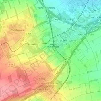
Name: Marienborn topographic map, elevation, terrain.

Location: Marienborn, Mainz, Rhineland-Palatinate, Germany (49.94748 8.20321 49.96849 8.24107)

Average elevation: 175 m

Minimum elevation: 136 m

Maximum elevation: 236 m

Other topographic maps

Click on a map to view its topography, its elevation and its terrain.

Steppe

Germany > Rhineland-Palatinate > Mainz

Average elevation: 122 m

Gear up for your next adventure:

🧦Thermal Socks - Warm socks for winter hiking or camping
🚲Handlebar Phone Mount - View topographic-map.com live while cycling
💧Reusable Water Bottle - Durable water bottles for hydration on trails
🛁Quick-Dry Microfiber Towel - Space-saving towel that dries rapidly on the move
🧢Beanie Hat - Keep your head warm in cold weather

As an Amazon Associate, this site earns from qualifying purchases at no extra cost to you.