Geolocate

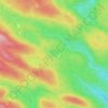
Val-Renard topographic map

Click on the map to display elevation.

About this map

Name: Val-Renard topographic map, elevation, terrain.

Location: Val-Renard, Gaspé, La Côte-de-Gaspé, Gaspésie–Îles-de-la-Madeleine, Québec, G4X 5P5, Canada (48.96773 -64.44079 49.00773 -64.40079)

Average elevation: 128 m

Minimum elevation: -3 m

Maximum elevation: 343 m

Other topographic maps

Click on a map to view its topography, its elevation and its terrain.

Lac Caribou

Canada > Québec > La Côte-de-Gaspé > Gaspé

Average elevation: 263 m

Gear up for your next adventure:

🥾Mountain Hiking Shoes - Shoes with superior grip for mountainous terrain
🥾Light Hiking Boots - Lightweight and comfortable boots for day hikes
👟Sport Hiking Sandals - Breathable footwear for water crossings and camp rest
🧴First Aid Kit - Essential first aid supplies for outdoor emergencies
🧴Sunscreen SPF - Broad-spectrum sunscreen for outdoor activities

As an Amazon Associate, this site earns from qualifying purchases at no extra cost to you.