Geolocate

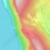
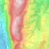
Le Vernay topographic map

Click on the map to display elevation.

About this map

Name: Le Vernay topographic map, elevation, terrain.

Location: Le Vernay, Mognard, Entrelacs, Chambéry, Savoie, Auvergne-Rhône-Alpes, France métropolitaine, 73410, France (45.72763 5.92649 45.76763 5.96649)

Average elevation: 413 m

Minimum elevation: 288 m

Maximum elevation: 563 m

Other topographic maps

Click on a map to view its topography, its elevation and its terrain.
Albens

France > Auvergne-Rhône-Alpes > Savoie > Entrelacs

Average elevation: 451 m

La Chambotte

France > Auvergne-Rhône-Alpes > Savoie > Entrelacs

Average elevation: 494 m

Épersy

France > Auvergne-Rhône-Alpes > Savoie > Entrelacs

Average elevation: 472 m

73410

France > Auvergne-Rhône-Alpes > Savoie > Entrelacs

Average elevation: 473 m

Saint-Girod

France > Auvergne-Rhône-Alpes > Savoie > Entrelacs

Average elevation: 432 m

Cessens

France > Auvergne-Rhône-Alpes > Savoie > Entrelacs

Average elevation: 621 m

Gear up for your next adventure:

🛰️Satellite Messenger - Emergency communication for areas with no cell service
🧥Thermal Fleece Jacket - Versatile insulation for changing mountain temperatures
⛺Bushcraft Tarp - Versatile emergency shelter or gear protection
🌬️Windproof Camp Stove - Efficient cooking even on exposed mountain peaks
💡Compact LED Flashlight - Powerful and portable flashlight for outdoor use

As an Amazon Associate, this site earns from qualifying purchases at no extra cost to you.