Geolocate

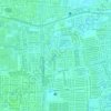
Lakarsantri topographic map

Click on the map to display elevation.

About this map

Name: Lakarsantri topographic map, elevation, terrain.

Location: Lakarsantri, Surabaya, East Java, Java, Indonesia (-7.33665 112.62610 -7.28840 112.67954)

Average elevation: 17 m

Minimum elevation: 5 m

Maximum elevation: 41 m

Other topographic maps

Click on a map to view its topography, its elevation and its terrain.

Caribbean Island

Indonesia > East Java > Surabaya > Keputih

Average elevation: 0 m

Taman Harmoni

Indonesia > East Java > Surabaya

Average elevation: 2 m

Taman Flora

Indonesia > East Java > Surabaya > Baratajaya

Average elevation: 5 m

Taman Suroboyo

Indonesia > East Java > Surabaya

Average elevation: 1 m

Caribbean Island

Indonesia > East Java > Surabaya

Average elevation: 0 m

Canberra

Indonesia > East Java > Surabaya > Manukan Wetan

Average elevation: 4 m

Taman Pelangi

Indonesia > East Java > Surabaya > Gayungan

Average elevation: 6 m

Gear up for your next adventure:

🍽️Titanium Camping Spork - Ultralight and indestructible eating utensil
🎒Hiking Backpack - Lightweight and ergonomic backpacks for day hikes or multi-day treks
🥾Trail Running Boots - Durable shoes designed for trail running
🧊Insulated Water Bottle - Keeps drinks cold in summer and prevents freezing in winter
🧴First Aid Kit - Essential first aid supplies for outdoor emergencies

As an Amazon Associate, this site earns from qualifying purchases at no extra cost to you.