Geolocate

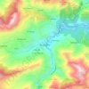
Taskriout topographic map

Click on the map to display elevation.

About this map

Name: Taskriout topographic map, elevation, terrain.

Location: Taskriout, Darguina District, Bejaia, 06621, Algeria (36.51828 5.21211 36.59300 5.30389)

Average elevation: 676 m

Minimum elevation: 71 m

Maximum elevation: 1,743 m

Other topographic maps

Click on a map to view its topography, its elevation and its terrain.
Bordj Mira

Algeria > Bejaia > Darguina District > Taskriout

Average elevation: 711 m

Gear up for your next adventure:

🧊Portable Cooler - Keep food and drinks cold during outdoor adventures
🧢Outdoor Visor - Breathable visor for sunny hikes
🧢Hiking Hat - Sun-protective and breathable hats for long treks
🧭GPS Tracker - Track your location in remote areas safely
🧥Softshell Jacket - Windproof and breathable jacket for hiking

As an Amazon Associate, this site earns from qualifying purchases at no extra cost to you.