Geolocate

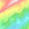
Teniet El Abed topographic map

Click on the map to display elevation.

About this map

Name: Teniet El Abed topographic map, elevation, terrain.

Location: Teniet El Abed, Teniet El Abed district, Batna, 05000, Algeria (35.21484 6.16039 35.35787 6.35976)

Average elevation: 1,608 m

Minimum elevation: 1,008 m

Maximum elevation: 2,307 m

Other topographic maps

Click on a map to view its topography, its elevation and its terrain.
Bayou

Algeria > Batna > Teniet El Abed district > Oued Taga

Average elevation: 1,452 m

Sara

Algeria > Batna > Teniet El Abed district > Teniet El Abed

Average elevation: 1,834 m

Gear up for your next adventure:

🛶Canoe Life Vest - Safety vest for water sports
🧥Softshell Hiking Jacket - The perfect balance of wind protection and breathability
🚲Handlebar Phone Mount - View topographic-map.com live while cycling
🧦Hiking Socks - Moisture-wicking and comfortable socks for long hikes
📷Outdoor Action Camera - Capture high-elevation views and rugged adventures

As an Amazon Associate, this site earns from qualifying purchases at no extra cost to you.