Geolocate

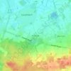
Dohren topographic map

Click on the map to display elevation.

About this map

Name: Dohren topographic map, elevation, terrain.

Location: Dohren, Samtgemeinde Herzlake, Landkreis Emsland, Nedersaksen, Duitsland (52.60951 7.54267 52.65832 7.65815)

Average elevation: 23 m

Minimum elevation: 16 m

Maximum elevation: 39 m

Other topographic maps

Click on a map to view its topography, its elevation and its terrain.

Gleesen

Duitsland > Nedersaksen > Landkreis Emsland

Average elevation: 29 m

Neusustrum

Duitsland > Nedersaksen > Landkreis Emsland

Average elevation: 11 m

Hesselte

Duitsland > Nedersaksen > Landkreis Emsland > Emsbüren

Average elevation: 31 m

Sprakel

Duitsland > Nedersaksen > Landkreis Emsland > Stavern

Average elevation: 39 m

Sand

Duitsland > Nedersaksen > Landkreis Emsland > Oberlangen

Average elevation: 10 m

Haar

Duitsland > Nedersaksen > Landkreis Emsland > Haren (Ems)

Average elevation: 15 m

Gear up for your next adventure:

💡Portable Camping Lamp - Rechargeable lamp for campsite lighting
☕Camping Coffee Maker - Brew fresh coffee anywhere on the topographic map
🔭Compact Monocular - One-handed bird watching and trail spotting
🧥Softshell Jacket - Windproof and breathable jacket for hiking
💡Compact LED Flashlight - Powerful and portable flashlight for outdoor use

As an Amazon Associate, this site earns from qualifying purchases at no extra cost to you.