Geolocate

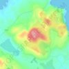
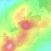
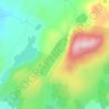
Rossgarrow topographic map

Click on the map to display elevation.

About this map

Name: Rossgarrow topographic map, elevation, terrain.

Location: Rossgarrow, Millford ED, Letterkenny, County Donegal, Ulster, Ireland (55.08999 -7.70720 55.10706 -7.69296)

Average elevation: 39 m

Minimum elevation: -3 m

Maximum elevation: 123 m

Other topographic maps

Click on a map to view its topography, its elevation and its terrain.
Letterkenny

Ireland > County Donegal > Letterkenny

Average elevation: 93 m

Manorcunningham

Ireland > County Donegal > Letterkenny

Average elevation: 43 m

Lough Nagreany

Ireland > County Donegal > Letterkenny

Average elevation: 36 m

Crockdonnelly

Ireland > County Donegal > Letterkenny

Average elevation: 51 m

Melmore Head

Ireland > County Donegal > Letterkenny

Average elevation: 9 m

Portsalon

Ireland > County Donegal > Letterkenny

Average elevation: 27 m

Glen Lough

Ireland > County Donegal > Letterkenny

Average elevation: 89 m

Carn Hill

Ireland > County Donegal > Letterkenny

Average elevation: 144 m

Melmore Head

Ireland > County Donegal > Letterkenny

Average elevation: 9 m

Lough Salt

Ireland > County Donegal > Letterkenny

Average elevation: 246 m

Gear up for your next adventure:

🥾Mountain Trail Shoes - High-traction shoes for mountain trails
🌬️Windproof Camp Stove - Efficient cooking even on exposed mountain peaks
🚑Survival Whistle - Signal for help across long distances in mountains
🦯Trekking Poles - Reduced impact on joints for steep topographic climbs
🐕Hiking Dog Pack - Let your canine companion carry their own water and food

As an Amazon Associate, this site earns from qualifying purchases at no extra cost to you.