Geolocate

Dabas topographic map

Click on the map to display elevation.

About this map

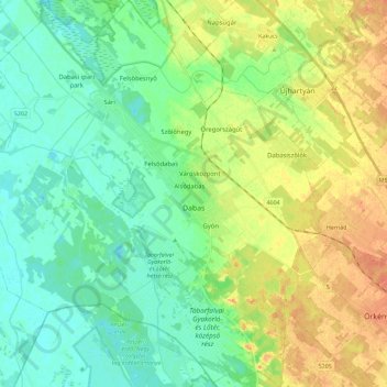
Name: Dabas topographic map, elevation, terrain.

Location: Dabas, Dabasi járás, Pest, Central Hungary, Hungary (47.10099 19.19306 47.25581 19.39806)

Average elevation: 108 m

Minimum elevation: 94 m

Maximum elevation: 130 m

Other topographic maps

Click on a map to view its topography, its elevation and its terrain.

Danube

Hungary > Pest > Göd

Average elevation: 111 m

Dunakeszi

Hungary > Pest > Dunakeszi > Dunakeszi

Average elevation: 124 m

Gear up for your next adventure:

🧰Survival Kit - Essential gear for emergencies in the wilderness
🚲Heavy Duty Bike Lock - Secure your bike at the trailhead or during stops
💧Hydration Pack - Hands-free hydration system for long hikes
🥾Approach Shoes - Shoes designed for climbing approaches and rugged trails
🛶Kayak Accessories - Essential gear for safe and fun kayaking adventures

As an Amazon Associate, this site earns from qualifying purchases at no extra cost to you.