Geolocate

Boma topographic map

Click on the map to display elevation.

About this map

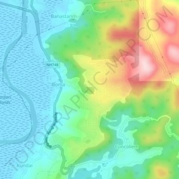
Name: Boma topographic map, elevation, terrain.

Location: Boma, Ponda, South Goa, Goa, 403115, India (15.45295 73.95043 15.49295 73.99043)

Average elevation: 88 m

Minimum elevation: -3 m

Maximum elevation: 289 m

Other topographic maps

Click on a map to view its topography, its elevation and its terrain.

Ponda

India > Goa > Ponda > Ponda

Average elevation: 62 m

Bandora

India > Goa > Ponda

Average elevation: 61 m

Gear up for your next adventure:

🌡️Emergency Mylar Blankets - Compact thermal protection for unexpected nights outdoors
🛰️Satellite Messenger - Emergency communication for areas with no cell service
🎒Backpack Rain Cover - External shield to keep your entire pack dry
🦯Trekking Poles - Reduced impact on joints for steep topographic climbs
🧊Portable Cooler - Keep food and drinks cold during outdoor adventures

As an Amazon Associate, this site earns from qualifying purchases at no extra cost to you.