Geolocate

Anjou topographic map

Click on the map to display elevation.

About this map
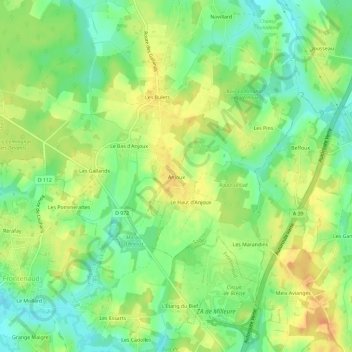
Name: Anjou topographic map, elevation, terrain.

Location: Anjou, Sagy, Louhans-Châteaurenaud, Saône-et-Loire, Bourgogne-Franche-Comté, France métropolitaine, 71580, France (46.54419 5.29933 46.58419 5.33933)

Average elevation: 203 m

Minimum elevation: 184 m

Maximum elevation: 221 m

Other topographic maps

Click on a map to view its topography, its elevation and its terrain.

Gear up for your next adventure:

🎒Fully Waterproof Backpack - Total protection for photography gear and electronics
🧥Thermal Fleece Jacket - Versatile insulation for changing mountain temperatures
🧊Portable Cooler - Keep food and drinks cold during outdoor adventures
🧤Insulated Winter Gloves - Heavy-duty protection for sub-zero Canadian adventures
⛺Camping Tent - Weather-resistant tents suitable for 2 to 6 people

As an Amazon Associate, this site earns from qualifying purchases at no extra cost to you.