Geolocate

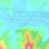
Văleni topographic map

Click on the map to display elevation.

About this map

Name: Văleni topographic map, elevation, terrain.

Location: Văleni, Vaslui, Romania (46.70494 27.69697 46.80596 27.79173)

Average elevation: 191 m

Minimum elevation: 102 m

Maximum elevation: 372 m

Other topographic maps

Click on a map to view its topography, its elevation and its terrain.

Huși

Romania > Vaslui

Average elevation: 129 m

Chițcani

Romania > Vaslui

Average elevation: 200 m

Huc

Romania > Vaslui

Average elevation: 163 m

Cujba

Romania > Vaslui

Average elevation: 277 m

Băbușa

Romania > Vaslui

Average elevation: 205 m

Ghermănești

Romania > Vaslui

Average elevation: 120 m

Mânzătești

Romania > Vaslui

Average elevation: 207 m

Gear up for your next adventure:

🧢Hiking Sun Hat - Wide-brimmed protection for exposed mountain ridges
🛏️Camping Sleeping Mat - Comfortable mats for sleeping outdoors
🧴Insect Repellent - Protect yourself from bugs during outdoor adventures
🧤Thermal Hiking Gloves - Grip-enhanced gloves for cold-weather altitude trekking
💧Collapsible Water Bottle - Space-saving water bottle for outdoor activities

As an Amazon Associate, this site earns from qualifying purchases at no extra cost to you.