Geolocate

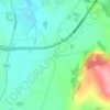
Ballinakill topographic map

Click on the map to display elevation.

About this map

Name: Ballinakill topographic map, elevation, terrain.

Location: Ballinakill, Ballinakill ED, The Municipal District of Portlaoise, County Laois, Leinster, R32 F663, Ireland (52.86933 -7.31628 52.88068 -7.29710)

Average elevation: 136 m

Minimum elevation: 96 m

Maximum elevation: 182 m

Other topographic maps

Click on a map to view its topography, its elevation and its terrain.

Timahoe

Ireland > County Laois

Average elevation: 146 m

Newtown

Ireland > County Laois

Average elevation: 187 m

Timahoe Round Tower

Ireland > County Laois

Average elevation: 137 m

Cullenagh Mountain

Ireland > County Laois

Average elevation: 226 m

Glasha

Ireland > County Laois

Average elevation: 58 m

Sheffield Cross

Ireland > County Laois

Average elevation: 119 m

Rosenallis

Ireland > County Laois

Average elevation: 114 m

Knockardagur

Ireland > County Laois

Average elevation: 248 m

Gear up for your next adventure:

🍽️Titanium Camping Spork - Ultralight and indestructible eating utensil
🔥Emergency Fire Starter - Reliable ignition source for all weather conditions
🛶Kayak Dry Bag - Waterproof storage for kayaking adventures
🔋Solar Power Bank - Keep your GPS and devices charged during long outdoor trips
💧Filtered Water Bottle - Safe drinking water on the go

As an Amazon Associate, this site earns from qualifying purchases at no extra cost to you.