
Padrón topographic map
Click on the map to display elevation.
About this map
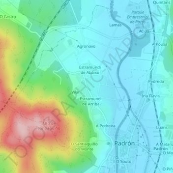
Name: Padrón topographic map, elevation, terrain.
Location: Padrón, Sar, La Coruña, Galicia, España (42.73514 -8.68611 42.76057 -8.65504)
Average elevation: 56 m
Minimum elevation: 2 m
Maximum elevation: 215 m
Other topographic maps
Click on a map to view its topography, its elevation and its terrain.