Geolocate

Wembdon topographic map

Click on the map to display elevation.

About this map

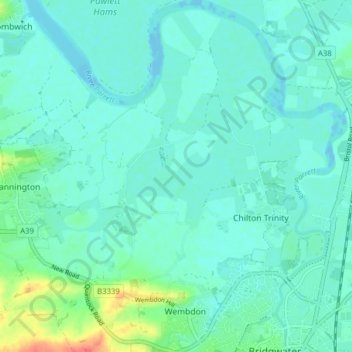
Name: Wembdon topographic map, elevation, terrain.

Location: Wembdon, Chilton Trinity, Somerset, England, United Kingdom (51.12811 -3.04996 51.17709 -3.00197)

Average elevation: 9 m

Minimum elevation: -8 m

Maximum elevation: 48 m

Gear up for your next adventure:

🚲MTB Frame Bag - Carry tools and maps directly on your bicycle frame
🥾Waterproof Trail Shoes - Shoes designed to handle wet terrain
🥾Trail Hiking Boots - Supportive boots for rough trails
🧢Hiking Sun Hat - Wide-brimmed protection for exposed mountain ridges
Lightweight Backpacking Tent - Compact tent for efficient hiking trips

As an Amazon Associate, this site earns from qualifying purchases at no extra cost to you.