Geolocate

Muara Tiga topographic map

Click on the map to display elevation.

About this map
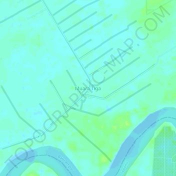
Name: Muara Tiga topographic map, elevation, terrain.

Location: Muara Tiga, Batu Ampar, Kubu Raya, West Kalimantan, Kalimantan, Indonesia (-0.83742 109.81875 -0.79742 109.85875)

Average elevation: 4 m

Minimum elevation: -3 m

Maximum elevation: 12 m

Other topographic maps

Click on a map to view its topography, its elevation and its terrain.

Sungai Ambawang

Indonesia > West Kalimantan > Kubu Raya

Average elevation: 10 m

Sungai Kakap

Indonesia > West Kalimantan > Kubu Raya

Average elevation: 2 m

Sungai Kakap

Indonesia > West Kalimantan > Kubu Raya

Average elevation: 2 m

Rasau Jaya

Indonesia > West Kalimantan > Kubu Raya

Average elevation: 5 m

Sungai Kakap

Indonesia > West Kalimantan > Kubu Raya

Average elevation: 2 m

Sungai Kakap

Indonesia > West Kalimantan > Kubu Raya

Average elevation: 2 m

Batu Ampar

Indonesia > West Kalimantan > Kubu Raya

Average elevation: 5 m

Gear up for your next adventure:

🔦LED Headtorch - Bright and durable light for night activities
🧢Outdoor Cap - Protective cap for sun and rain during hikes
🧦Hiking Socks - Moisture-wicking and comfortable socks for long hikes
👟Leg Gaiters - Keep debris, mud, and snow out of your boots
🥾Hiking Gaiters - Protect legs and shoes from mud, snow, and debris

As an Amazon Associate, this site earns from qualifying purchases at no extra cost to you.