Geolocate

Banyo topographic map

Click on the map to display elevation.

About this map

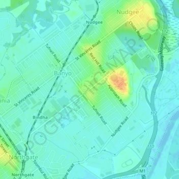
Name: Banyo topographic map, elevation, terrain.

Location: Banyo, Brisbane City, Queensland, 4014, Australia (-27.39474 153.06534 -27.36323 153.09614)

Average elevation: 8 m

Minimum elevation: -4 m

Maximum elevation: 33 m

Other topographic maps

Click on a map to view its topography, its elevation and its terrain.

Grange Heights

Australia > Queensland > Brisbane City

Average elevation: 34 m

Gear up for your next adventure:

🧤Insulated Winter Gloves - Heavy-duty protection for sub-zero Canadian adventures
🧥Packable Rain Jacket - Breathable waterproof layer for unpredictable weather
🕶️Polarized Sunglasses - Reduces glare from snow and water at high elevations
🚲Bike Repair Kit - Essential tools for on-trail mechanical issues
🧴First Aid Kit - Essential first aid supplies for outdoor emergencies

As an Amazon Associate, this site earns from qualifying purchases at no extra cost to you.