Geolocate

Matara topographic map

Click on the map to display elevation.

About this map

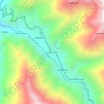
Name: Matara topographic map, elevation, terrain.

Location: Matara, Lambrama, Abancay, Apurímac, Perú (-13.76161 -72.91953 -13.72161 -72.87953)

Average elevation: 2,466 m

Minimum elevation: 1,903 m

Maximum elevation: 3,263 m

Gear up for your next adventure:

🔦LED Headlamp - Hands-free lighting for early morning starts or late finishes
🧥Waterproof Pants - Keep dry during rainy hiking conditions
🧰Multitool Knife - Compact and versatile tool for outdoor use
🔦LED Flashlight - Powerful and long-lasting flashlight for camping and emergencies
🧦Hiking Socks - Moisture-wicking and comfortable socks for long hikes

As an Amazon Associate, this site earns from qualifying purchases at no extra cost to you.