
Thank you for supporting this site ❤️
Make a donation
Make a donation
Gear up for your next adventure:
As an Amazon Associate, this site earns from qualifying purchases at no extra cost to you.
Rosenkogel topographic map
Click on the map to display elevation.
Thank you for supporting this site ❤️
Make a donation
Make a donation
Gear up for your next adventure:
As an Amazon Associate, this site earns from qualifying purchases at no extra cost to you.
About this map
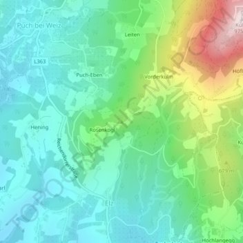
Name: Rosenkogel topographic map, elevation, terrain.
Location: Rosenkogel, Puch bei Weiz, Bezirk Weiz, Styria, 8182, Austria (47.21398 15.73927 47.21408 15.73937)
Average elevation: 542 m
Minimum elevation: 386 m
Maximum elevation: 970 m
Thank you for supporting this site ❤️
Make a donation
Make a donation
Gear up for your next adventure:
As an Amazon Associate, this site earns from qualifying purchases at no extra cost to you.